-
-
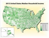
United States Median Household Income (2013)
-
A map showing the median household income of the United States in 2013., Image created using ArcGIS.
Data from: http://factfinder.census.gov/faces/nav/jsf/pages/searchresults.xhtml?refresh=t
-
-
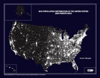
United States Population Distribution (2010)
-
The 2010 Population Distribution in the United States and Puerto Rico map (also referred to as the "Nighttime Map"), portrays the distribution of population in the United States and Puerto Rico based on the results of the 2010 Census of Population and Housing. Each white dot represents 7,500 people.
-
-
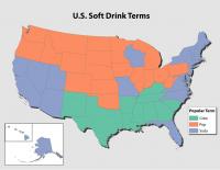
United States Soft Drink Terms
-
A map showing the distribution of the different terms Americans use for soda pop., Image created using ArcGIS.
Data From: http://www.popvssoda.com/statistics/ALL.html
-
-
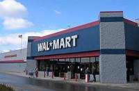
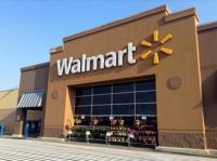
Walmart
-
A photograph of a Walmart from the view of the parking lot.
-
-
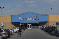
Walmart
-
A photography of the front of a Walmart in Waturbury, Connecticut.
-
-
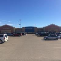
Walmart
-
A photograph of a Walmart from the view of the parking lot in Richmond Hill, Ontario.
-
-
Walmart
-
A Wal-Mart from the view of the parking lot.
-
-
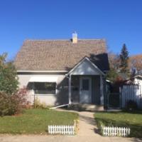
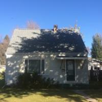
Wartime House
-
A photograph of a wartime house in Saskatoon, Saskatchewan. The house is still inhabited today.
-
-
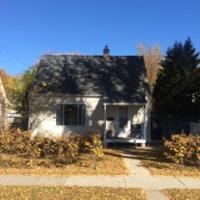
Wartime House
-
A photograph of a wartime house in Saskatoon, Saskatchewan. The house is still inhabited today.
-
-
Wartime House
-
A photograph of a wartime house in Saskatoon, Saskatchewan. The house is still inhabited today.
-
-
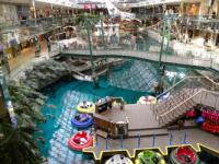
West Edmonton Mall
-
A photograph of one of the many tourist attractions inside West Edmonton Mall, Edmonton, Alberta.
-
-
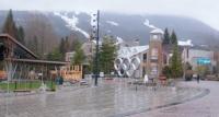
Whistler Plaza
-
A photo of the Olympic Logo Plaza in Whistler, British Colombia.
-
-
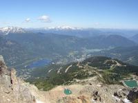
Whistler, British Colombia
-
Picture taken from whistler mountain and shows the town of Whistler, British Colombia and it surroundings. Taken in summer.
-
-
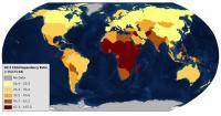
World Child Dependency Ratio (2015)
-
A map showing the global child dependency ratio in 2015., Image created using Esri Basemaps and ArchGIS
Data From: https://esa.un.org/unpd/wpp/Download/Standard/Population/