-
-
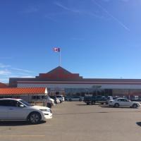
Home Depot
-
A view of Home Depot from the parking lot.
-
-
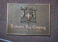
Hudson's Bay Company
-
A photograph of a Hudson's Bay Company (HBC) plaque. The HBC is Canada's oldest company.
-
-
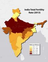
India Total Fertility Rate (2013)
-
A map showing the total fertility rates in India in 2013 by region., Image created using Esri Basemaps and ArcGIS.
Data From: http://www.censusindia.gov.in/vital_statistics/SRS_Reports_2013.html
-
-
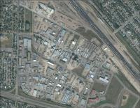
Industrial Park
-
A satellite image of an urban industrial park. Of note are the residential zones surrounding the industrial park along with a major urban transportation vein through the centre of the image., Image created using Esri Basemaps.
-

-
Knox United Church
-
A photograph of the Knox United Church, a municipal heritage building in Saskatoon, Saskatchewan.
-
-
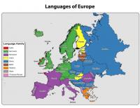
Languages of Europe
-
A map showing the distribution of language families spoken in Europe., Image created using Esri Basemaps and ArcGIS.
Data From: http://www.nationsonline.org/oneworld/european_languages.htm, http://www.listlanguage.com/european-languages-tree.html.
-
-
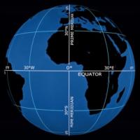
Latitude and Longitude
-
This image shows the relationship between latitude and longitude lines on Earth. Highlighted areas include the equator and prime meridian. Degrees of latitude and longitude are scaled out at 30 degree increments.
-
-
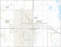
Lloydminster, Canada
-
A map of the city of Llyodminster, Canada. Llyodminster straddles the provincial boundaries of Alberta and Saskatchewan., Image created using Esri Basemaps and ArcGIS.
-
-
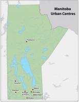
Manitoba Urban Centres
-
A map showing the distribution of the major urban centres in Manitoba. This real-world pattern encompasses two relatively distinct regions: a sparsely settled centre and north and, by comparison, a densely settled south, Image created using ArcGIS.